NOTE: IN ORDER TO BETTER SEE PHOTOS IN THEIR FULL 1600 PX. RESOLUTION, VIEW THEM IN THE ALBUM FORMAT BY CLICKING ON THE LEAD PHOTO OR ANY PHOTO IN THE POST. This is especially true for landscape shots. Thanks to Mark for the idea of adding this alert so the photos can be seen at their best!
Showing posts with label National Monument. Show all posts

Wednesday, September 14, 2016

Scott's Bluff Stopover

One last lonely post from our trip out west!  On our way from Estes Park to South Dakota we stopped a night at Scott's Bluff, Nebraska.  We stayed at the Riverside Campground run by the city for a very reasonable $25 and had a site that was easily 5 times as big as our one in Estes Park for half the price!


It was a short walk from the campground down to the river with a view of Scott's Bluff on the other side.  Or you could walk to the zoo like Cory and I did in the morning before we packed up the RV.


It was quite something to hear the tiger roaring while hanging out at our campsite, but when we got to the zoo it was nowhere to be found.  Quite a few of the main attraction animals weren't "let out" yet by zoo staff for the day but it was still a pleasant stroll before hitting the road.


Just after dawn I snuck out of the campground and headed over to the National Monument for a peek by myself.
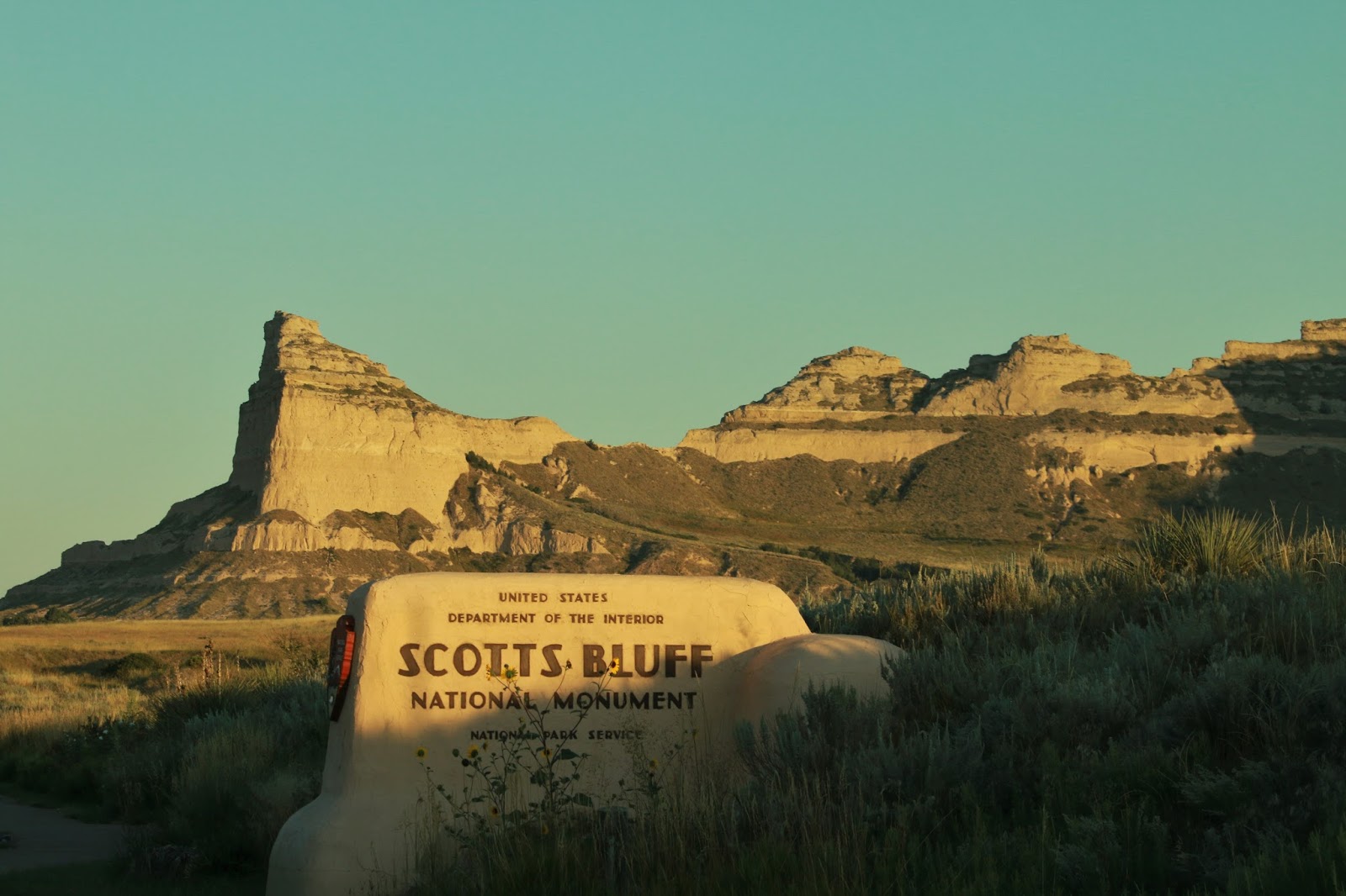

The history of the Oregon Trail is not as big a thrill for Canadian born Wayne and early in the day the road up to the top of the bluff is closed to vehicle traffic.  But I enjoyed walking around the grounds looking for good shots and getting my exercise before the heat of the plains really got going.


Scotts Bluff rises 800 feet above the North Platte River and has served as a landmark for peoples from Native Americans to emigrants on the Oregon, California and Mormon Trails.


Over 250,000 people made their way through the area between 1843 and 1869, and many of them referred to the landmark in the journals.

taken with my iPhone!

From the National Oregon/California Trail website:
To survive the long jouney, a family of four would need 600 lbs. of flour, 120 lbs. of biscuits, 400 lbs. of bacon, 60 lbs. of coffee, 4 lbs. of tea, 100 lbs. of sugar, and 200 lbs. of lard. These would just be the basic staples. Other food stuffs could include sacks of rice and beans, plus dried peaches and apples. Bacon was often hauled in large barrels packed in bran so the hot sun would not melt the fat. Each man took a rifle or shotgun and some added a pistol. A good hunting knife was essential. 


In the early days of the trail when game was more abundant near the trail, pioneers could often kill buffalo and antelope.  However, a more dependable supply of fresh meat was to bring along a small herd of cattle and trail them behind the wagon.   Many also brought along a cow for milking purposes.  Milk could also be churned into butter by simply hanging it in pails beneath the bumpy wagon.  By the end of  the day fresh butter would be ready.

Want to know what a day on the trail was like?  Check out this link.  Think Indians were the biggest threat on the trail?  Think again, getting run over by wagon wheels was the leading cause of death!  I know that will me think of my car a little more fondly next time I load up supplies for a trip.

Monday, March 7, 2016

Lincoln's Birthplace - Kentucky Born

I'll start with letting my readers know that their wonderful comments on my previous post about Cory touched me deeply.  Thank you so much for your supportive words, and I'm glad to know that my words are reaching other people and perhaps making a difference as we all work towards improvement in the field of mental health treatment!

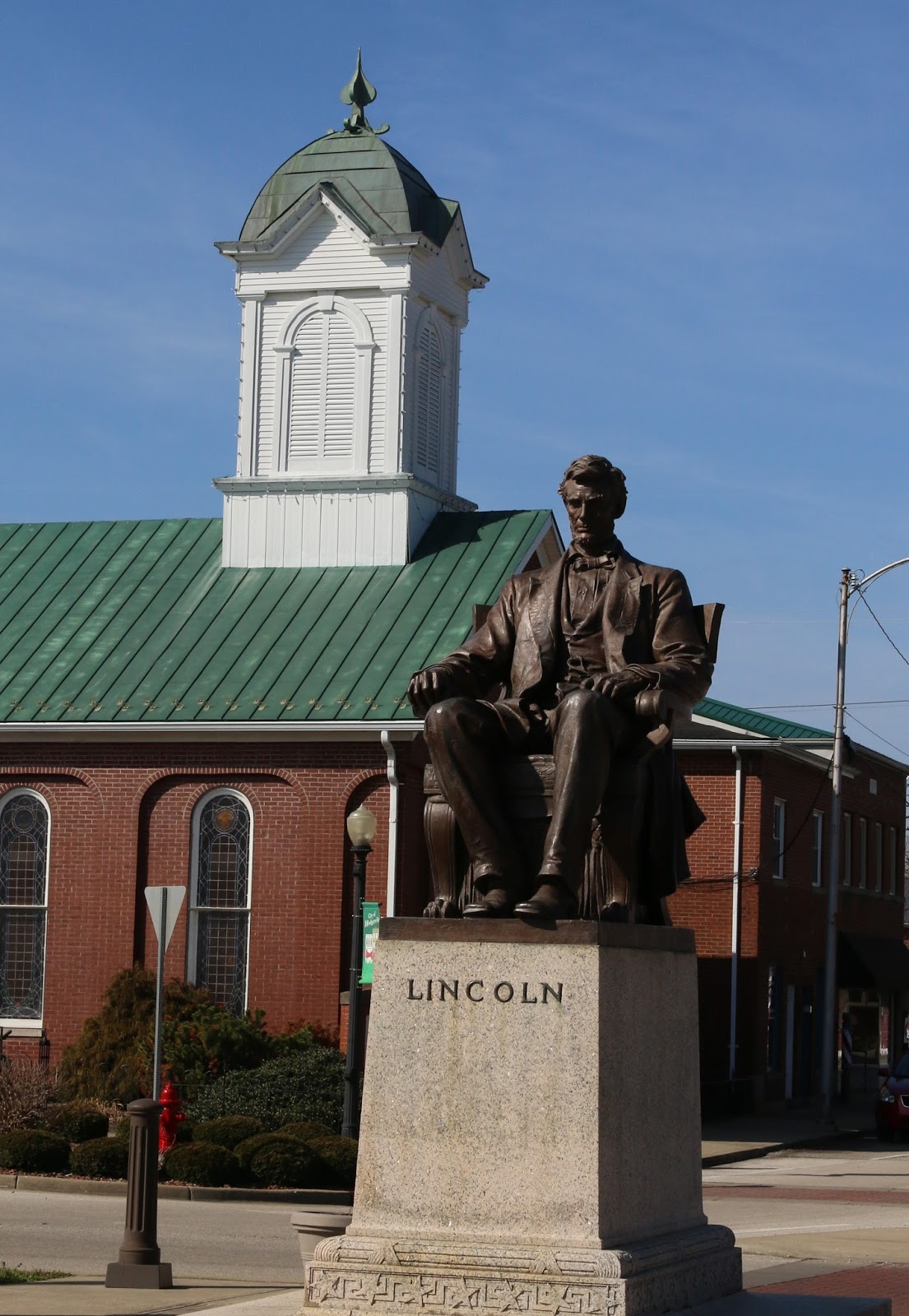
Since I spent most of my school years living in Illinois the phrase "Land of Lincoln" pops about as naturally into my head as "Give a Hoot, don't pollute" or "Silly Rabbit, Trix are for kids!" so I was a bit surprised to see a sign on the highway for the Abraham Lincoln Birthplace National Historical Park.  Never one to pass up a National Park of any kind if I can help it I took the exit and even though it was a little bit out of my way I ended up being really glad that I did.  On my way there I passed through the town of Hodgenville where a bronze statue erected for the Lincoln Centennial in 1909 stands.  It was carved by the same sculptor who created the Lincoln statue I viewed not long ago in Kentucky's Capitol.


A few miles outside of the small square in Hodgenville is where his birthplace is located.  First off let me say that upon entering the visitor center I was directed to go in and see the movie which had just started.  While I don't always enjoy the movies, this one was a winner.  It was so good, in fact, that I'm including  the link here for you to watch!  I wish it was available on YouTube to make all our lives easier and embed it directly in the post, but alas it is not.

Thomas and Nancy with baby Abraham
and his older sister, Sarah

If you don't watch the video some of the interesting things I learned was that while Lincoln was "born in a one-room log cabin" this was not the devastating humble beginning that it has been overdramatized to be.  They lived on the frontier, after all, mansions and McDonald's were not to be found at the edge of civilization!  Tax records show that Abe's father Thomas was doing well for himself as a farmer in those Kentucky years and their life might have been filled with hard work and humble lodgings, but they were well respected and probably considered middle-class. Pieces of that log cabin survived and a replica was constructed and ensconced inside the memorial that I visited.


The Lincoln family story is one of migration, which was fascinating too.  His pioneer grandfather came from Massachusetts through the Cumberland Pass to Virginia where he settled in what is now Kentucky.  When Lincoln was 7 years old his family moved from Kentucky to Indiana to farm there due to land rights battles and apparently it did not go as well.   And when he was 21 he moved with his father and stepmother to Illinois... Land of Adult Lincoln, apparently!


How dare Illinois lay claim to Lincoln, right?  But we won't talk about those later years here, we'll talk about that young Kentucky boy.

another bronze in the square of Hodgenville


Another interesting fact was that Abe received very little formal schooling in Kentucky due to that same frontier environment.  School was a two mile walk each way in the second farm they had a few miles down the road, and he and his sister attended very irregularly.  I wonder how much more "formal" schooling he got in Indiana?  Lincoln himself admitted that the total amount of schooling he received in his very rural childhood was no more than twelve months; nevertheless, he became an excellent reader, learned to write, measure, and make division and multiplication calculations during his childhood.  I've always loved stories like this that demonstrate that pursuit of knowledge is the best teacher!


He wasn't called "Honest Abe" for nothing, and while as a boy he was a bit of a prankster he had a big heart and did not enjoy killing animals for sport.  And of course, his anti-slavery views evolved and became the stuff of legend.  The young president cut down in his prime was so revered that this Memorial's cornerstone was laid 44 years after his death on what would have been his 100th birthday.


It's a beautiful building, constructed over the spring that made this spot so valuable to his father and the 56 stairs leading up to it signify the 56 years of his life.


So my final thought here is a reminder for us all to encourage those youth from humble beginnings with little education.  Who knows where they could go if they put their minds to it?

Tuesday, August 20, 2013

Pipestone National Monument

The Pipestone National Monument was only half an hour drive from Blue Mounds State Park, so of course we had to go.  There is a $3 dollar entrance fee per adult, but if you have the National Parks pass you're covered.  This year the only National Park we are hitting is the Smokies, and it's one of the parks that doesn't charge so we don't have a pass and paid the fee. (By the way, Sharon, since I now know that you haven't been getting my replies in the comment section, I will be contacting you shortly before I get to Tennessee!)

Most of the rock at Pipestone is Sioux Quartzite, but layers of catlinite are sandwiched between them here and there.  The Sioux Quartzite is harder then ordinary steel, but the catlinite is very soft similar to human fingernails.  Its softness is what makes it ideal for pipe carving.  Geology rocks, right?

We took the 3/4 mile trail through the monument.  Signs are scattered throughout with information on the prairie ecology and other natural features.


Our favorite was the Old Stone Face.  You could see him from above and below, but I like the view from above better.


For the last 3000 years the Plains tribes have traveled across the region to quarry pipestone here.  The task of extracting pipestone from the earth is a slow and labor intensive process and the hand tools used today are not much more advanced than the tools and methods used in centuries past. The process can require many days of physical labor with only the use of hand tools such as sledgehammers, pry bars, chisels, wedges, and steel bars allowed.

Prayer cloths were also located throughout the trail, we did not touch or disturb them.


The big surprise was a collection of petroglyphs!  Historically, there were 79 petroglyphs on 35 slabs of rock placed around the Three Maidens, granite boulders dropped here by glaciers. The carvings depicted various forms such as people, animals, bird tracks, and more. The petroglyphs were removed in 1888 or 1889 after some had been defaced. The stones changed locations many times before some of them were returned to Pipestone National Monument in the mid-1900s. Seventeen of the petroglyphs are now on display in the Visitor Center.


From the NPS website:
Black Elk, who, for a time, traveled with the Buffalo Bill Show, committed many traditional stories to print. His contributions are invaluable to anyone who wishes to learn more about the traditions of his people. As recorded and edited by Joseph Epes Brown in The Sacred Pipe: Black Elk's Account of the Seven Rites of the Oglala Sioux, Black Elk told the story of the gift of the pipe from White Buffalo Calf Woman, a wakanwoman, who presents the people with a pipe before leaving the village and morphing into a white buffalo calf.

"'Behold this and always love it! It is lela wakan [very sacred], and you must treat it as such. No impure man should ever be allowed to see it, for within this bundle there is a sacred pipe. With this you will, during the winters to come, send your voices to Wakan-Tanka, your Father and Grandfather.'

After the mysterious woman said this, she took from the bundle a pipe, and also a small round stone which she placed upon the ground. Holding the pipe up with its stem to the heavens, she said: 'With this sacred pipe you will walk upon the Earth; for the Earth is your Grandmother and Mother, and She is sacred. Every step that is taken upon Her should be as a prayer. The bowl of this pipe is of red stone; it is the Earth. Carved in the stone and facing the center is this buffalo calf who represents all the four-leggeds who live upon your Mother. The stem of the pipe is wood, and this represents all that grows upon the Earth. And these twelve feathers which hang here where the stem fits into the bowl are from Wanbli Galeshka, the Spotted Eagle, and they represent the eagle and all the wingeds of the air. All these peoples, and all the things of the universe, are joined to you who smoke the pipe - all send their voices to Wakan-Tanka, the Great Spirit. When you pray with this pipe, you pray for and with everything.'"


There was an artist carving in the visitor center, but by the time I wandered over they were gone.  Pipes are for sale as well, perhaps when we're retired we'll stop back and buy one. While I didn't take any pictures of the pipes themselves I did like this sculpture.  Stop in if you're in the area.  I know I plan on visiting more sites like this to learn about the people who called America home before we did.


Thursday, April 11, 2013

The Big Heads, 2009


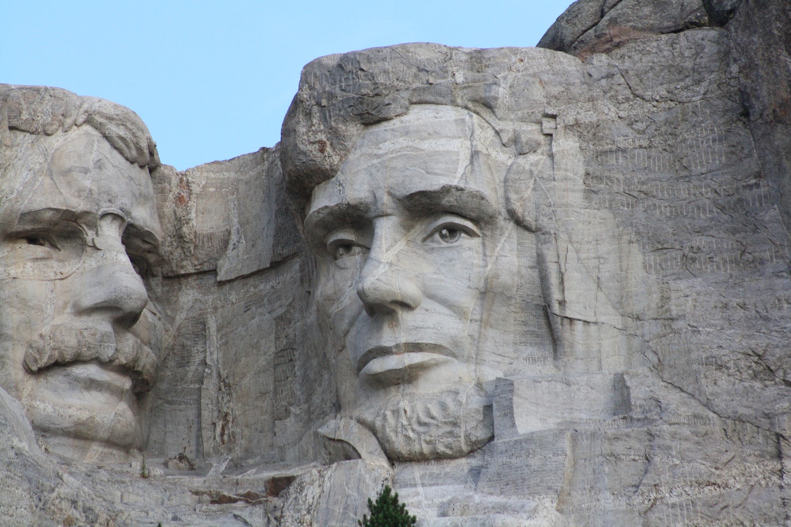
The Big Heads! Is there anything more American?  I remember dusting a souvenir bust of these guys as a child that we kept on our shelves, but I was so young when we visited them that I didn't recall seeing them in person.  Our big trip west in 2009 included a stop at Mt. Rushmore, and I never thought to ask Wayne what he thought of this monument as a Canadian.  I forget sometimes that he's not a native and didn't grow up being steeped in the tales of our famous presidents as I did in grade school.


"Let us place there, carved, high, as close to heaven as we can, the words of our leaders, their faces, to show posterity what manner of men they were.  Then breathe a prayer that these records will endure until the wind and the rain alone shall wear them away."  - Gutzon Borglum.

Borglum was born to immigrant parents in Idaho in 1867, and began work on Mt. Rushmore in 1927.  He remained devoted to the project until his death several days befor his 74th birthday.  After his death the project fell to his son, Lincoln, who in turn put the finishing touches on his father's vision.


Over the fourteen year period of the carving almost 400 workers, men and women, labored at the Memorial.  Despite harsh and dangerous conditions, there were no fatalities during the carving work.


Taking the walk below the carvings on the boardwalk gives a great look into the amazing details that went into the work, such as Roosevelt's glasses and mustache!  By the way, rumors that they would ever add another president's head to the mountain are false.  The work is complete and will remain untouched.  You have to see it in person to appreciate the immensity of the task that was undertaken.


While we were posing at the railing, we got a glimpse of a mountain goat grazing in the auditorium area.  I later learned that the mountain goat is not actually a true goat, but actually a mountain antelope.  She had a kid nearby, but I couldn't get a good shot because of the trees and tall grass.


We soon learned there is more than one way to enjoy Mt. Rushmore.  The Iron Mountain Road is known for its series of pigtail bridges and its three single-lane granite tunnels that perfectly frame the faces of Mount Rushmore.  We lucked upon this fact when spying them in the rearview mirror as we went through the tunnel.  There are pull-offs outside the tunnels and we pulled over to get a shot at the same time as a tour group.  Wayne asked the tour guide for details, and we got the inside scoop for free! 

 
I'll leave you with some presidential words of wisdom:

"Believing that a representative government, responsible at short periods of election, is that which produces the greatest sum of happiness to mankind, I feel it a duty to do no act which shall essentially impair that principle."  - George Washington

"We act not for ourselves, but for the whole human race.  The event of our experiment is to show whether man can be trusted with self-government."  - Thomas Jefferson

"The first requisite of a good citizen in this Republic of ours is that he shall be able and willing to pull his weight - that he shall not be a mere passenger."  - Theodore Roosevelt

"I leave you hoping that the lamp of liberty will burn in your bosoms until ther shall no longer be a doubt that all men are created free and equal."   - Abraham Lincoln

Saturday, December 8, 2012

Blast Off to the Badlands, 2011

As I've mentioned in a few posts recently we took a trip to South Dakota with my mom and dad back in June of 2011.  Our first stop was the Badlands and we stayed at Sleepy Hollow RV Park.  Having stayed at the other park in town on our previous visit, we can say with confidence that Sleepy Hollow is definitely the better choice.  The owners were very friendly, laundry was reasonably priced, and the campground was clean and well kept.  The same could not be said of the other joint when we visited. 

Side by side Laredos for us!

We didn't stay long, but took a swing through the Badlands National Park and through the shops in Wall.  I'm not much of a shopper, but my mother picked up a bunch of Harley Davidson shirts for her brother.

No one takes a shot like my tripod!
Flower identification appreciated

Like the good folks at Good Luck Duck, we sprung for a missile tour, but ours was at the Minuteman Missile National Historic Site in South Dakota instead of Arizona. The NPS website has this great link to a collection of oral histories from former missile field personnel and local citizens who were part of the Minuteman's history for over three decades.  We took the tour  31 feet underground and got to check out the launch center. I was particularly fond of the artwork.


Being a bit younger than some of my fellow RV bloggers, this piece of our history was just a little bit before my time. The cold war was winding down a bit in my day, so a lot of the information we learned was pretty new to us.  During the height of the Cold War, 1,000 Minuteman missiles were operational in six missile wings across North and South Dakota, Wyoming, Montana, Colorado, Nebraska, and Missouri.  Interestingly, the launch control facilities and missile silos of the Cold War, and even those that exist today, were never a secret. Many community members even participated in the construction. The locations of these sites were never kept secret from the Soviet Union, either.  If you want to know more, visit a site on your travels!

Saturday, October 20, 2012

Devil's Tower National Monument, June 2011

While in Custer, South Dakota in 2011 we took a daytrip to Devil's Tower National Monument.
 President Theodore Roosevelt established Devil's Tower as the nation’s first national
monument on September 24, 1906.
Devil's Tower is a monolithic igneous intrusion; several geologists believe the molten rock comprising the Tower might not have surfaced, other researchers are convinced the tower is all that remains of what once was a large explosive volcano. 

There are plenty of opportunities to stop along the road and gawk on the way in, but it was a bit hairy when we came to a section of the road that had fallen away on a high curve.  I couldn't get a picture because there was no place to stop without holding up traffic, but it was quite a sight to see a chunk of what used to be road hanging out over a big drop!  There is a nice 40 site park service campground on the way in with views of the tower and the Belle Fourche River. There is no dump station or hookups at this site which is why we came as a daytrip from Custer.


The picture above was taken from the parking lot by the visitor center, which we visited to learn about the tower's formation and history. As the magma rock cooled, it contracted, forming hexagonal (and sometime 4-, 5- and 7-sided) columns separated by vertical cracks.


A 1.5 hour ranger led hike around the base of the tower is offered, but we took the less traveled 2.8 mile Red Beds Trail around the monument to enjoy the surrounding views and get a feel for the tower as part of its surroundings.  The trail starts off at the base of the tower and meanders through a Ponderosa Pine forest.  After hiking about 3/4 mile the forest comes out into some beautiful meadows with views of the area.  The going gets a little more difficult with a series of swithbacks that lead down and away from the tower. 


Soon you enter an area with red clay and sand that give the trail its name.  We couldn't believe how much the terrain of the trail kept changing! I don't think we've ever been on shorter trail that had such variety of habitat.


After turning back toward the tower you have to climb back up toward it and we had to stop a few times to catch our breath, but the reward is getting to a side of the tower you can't see from most spots in the park. Very cool, and we came upon a ranger just minutes afterward to finish our walk with. We learned from her that there is a whole ecosystem on the top, including deer and even snakes!