NOTE: IN ORDER TO BETTER SEE PHOTOS IN THEIR FULL 1600 PX. RESOLUTION, VIEW THEM IN THE ALBUM FORMAT BY CLICKING ON THE LEAD PHOTO OR ANY PHOTO IN THE POST. This is especially true for landscape shots. Thanks to Mark for the idea of adding this alert so the photos can be seen at their best!
Showing posts with label National Lakeshore. Show all posts

Saturday, July 11, 2015

Beaver Lake and More than I Thought I'd See

Even though I was warned away from Beaver Lake because of the mosquitoes I couldn't resist stopping to have a look.  It's a long, narrow, sometimes steep drive from the main road to the campground with size restrictions posted at the entrance.  I wouldn't take anything bigger than a pop-up down that road if it were me, and there are only 8 first come first served campsites so it's a big risk for anything other than tenters.  Also, none of the NPS of USFS campgrounds on the National Lakeshore have flush toilets or showers so be prepared.


The trail to Beaver Lake was 3 miles roundtrip so I figured I'd give it a try.  I wore long sleeve pants and shirt, and sprayed Bug Me Not on exposed skin and on my shirt too.  Not that it seemed to help much, but if I kept moving I only had to slap a mosquito every five minutes or so.


There is a steep drop at the beginning of the trail but then the descent becomes gradual as you meet up with a little stream.


Boardwalks are pretty, but usually good indicators of a mosquito breeding ground, right?


Exposed rocks were a surprise along the trail.  Limestone?  Sandstone?  No time to investigate.


By the halfway mark I was sweating like crazy, sucking back water, but I was going to see Beaver Lake!  Also, signs indicated I could make it all the way to Lake Superior and maybe there would be some relief from the heat.


Crossing in to the Beaver Basin Wilderness there was so much sand and lichen that the ground almost looked like it had snowed!


Beaver Lake was pretty, and even when I clambered through the shrubs and under trees to get the shot I wanted of the dam I didn't pick up any ticks.


As I neared Lake Superior I did start picking up stable flies though.  And their bites hurt, so at the water's edge I stripped off my sweaty shirt for a few minutes but left everything else on.


Another lady on the beach was braver (or more stupid?) than me.  She was walking up and down a strip of sand by the water, naked as can be.  Her companion left his long sleeves and pants on the whole time, but I'm sure he enjoyed the show she was putting on.


Another walk on the beach Wayne sure would have enjoyed!

Friday, July 10, 2015

Roses and More


To fill in the details from yesterday's post, Au Sable Light is located 12 miles west of Grand Marais and an hour's drive east of Munising.  Built in 1874, the light tower's base diameter is 16 feet with a height of 87 feet.  It is still operational, and tours are conducted for $3 I think it was Wednesday though Sunday.  It is only minutes from Twelvmile Beach campground where I am staying for two nights.  Two days of fighting the mosquitoes and stable flies is enough for me, not that I'm likely to find relief from mosquitoes anywhere within a day's drive unfortunately.  I keep forgetting to take a picture of my campsite, I'll make sure to do that this afternoon.

Wild roses along the path to Au Sable Light

If I keep moving I'm less of a target, but they always find me, even with long sleeves on and my natural repellent sprayed on the sleeves.  I got so many bites on my hands (that I sprayed!) that I'm feeling a bit discouraged at the moment so I took a trip in to downtown Munising's Falling Rock Cafe to escape them.  They have free wifi, books, coffee, sandwiches, soup and even ice cream.

Smooth Wild Rose?

The display of wild roses along the path to the light was pretty impressive, standing taller than the prairie rose I kept seeing on the Ice Age Trail.  Did I mention that the path is also part of the North Country Trail?  Unlike the IAT the NCT has easy access to camping and clean drinking water.  It also has shuttle services available for $20, something I'd consider doing to know for certain I'd have a ride for a longer hike.  I walked for awhile with a hiker named James who was doing his first overnight trip on the trail.  He was walking 42 miles in 4 days and took a shuttle to be dropped off so that's how I knew about the cost of the shuttle.


Wildflowers were more numerous on this section than other areas I've explored the last two days.  This little one below may be an invasive, I couldn't find it anywhere when I tried to research it.


The plant is only a couple of inches tall.  Anyone know what it is?


Past the Au Sable light you can continue on the North Country Trail if you like.  I went the half mile further in just to make my hike an even 4 miles roundtrip.


The trail was shady with views of Lake Superior popping into view now and then.


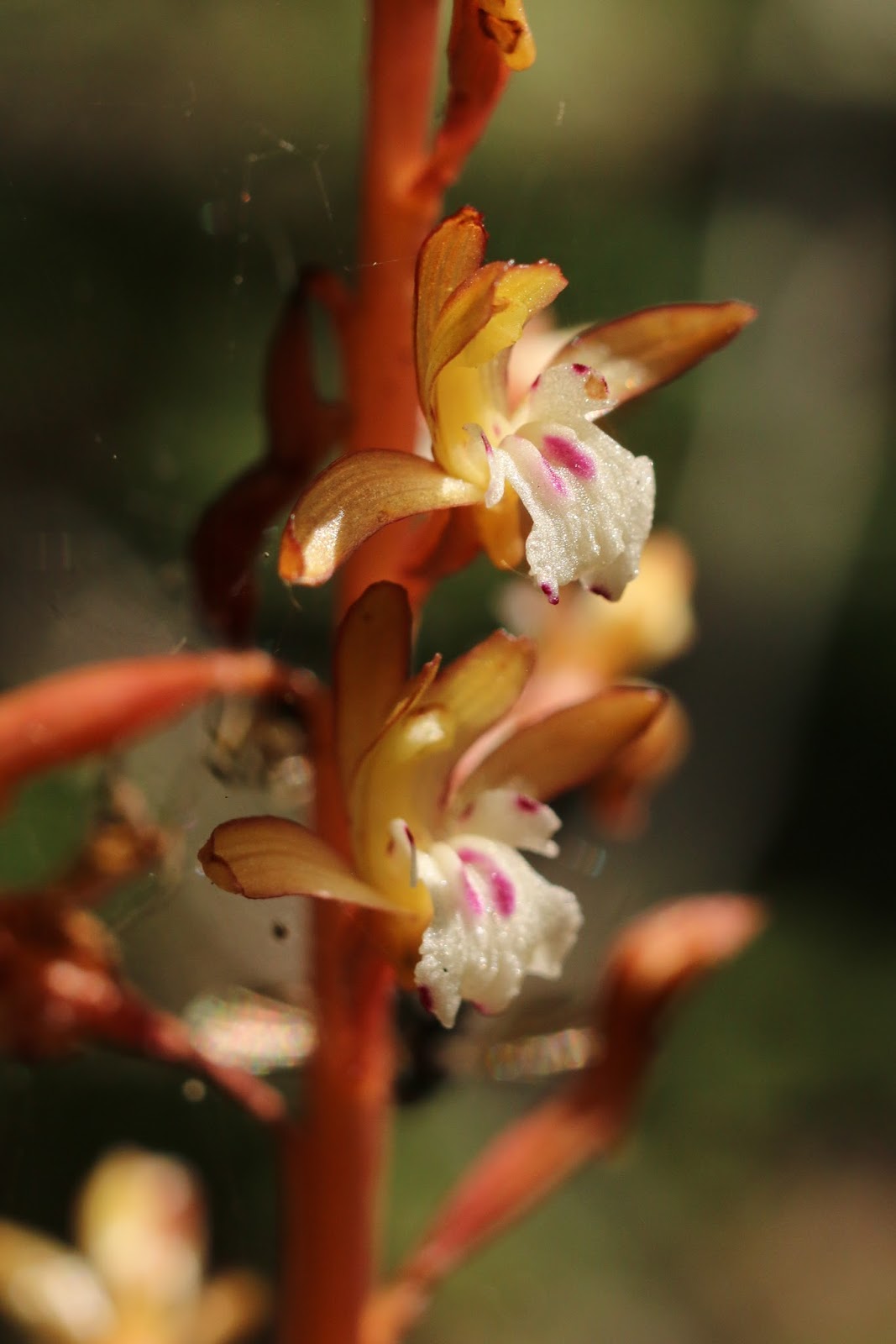
On the way back, I noticed tons of Coralroot.  It was tall and growing in groups but I had missed it on my way up because I had escaped the bugs to walk on the shore.


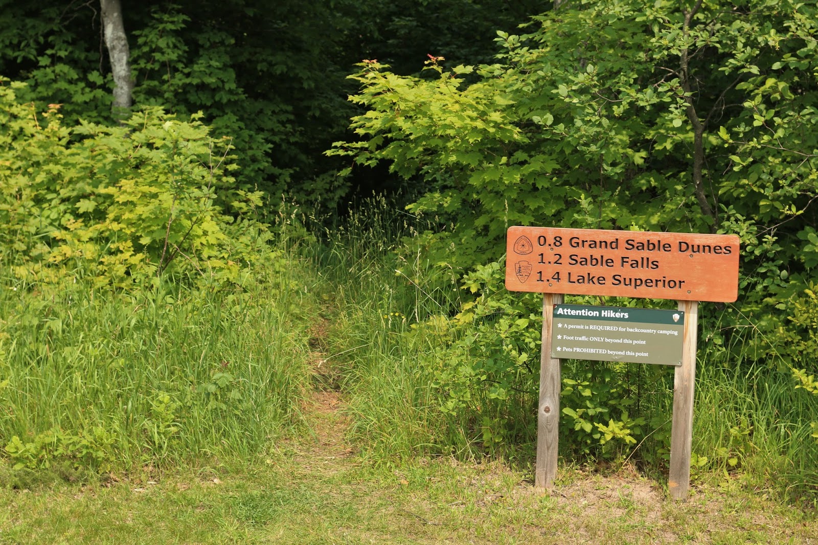
Always a glutton when it comes to hiking I also sampled the Sable Falls trail on the same afternoon.  I parked at the Grand Sable visitor center and the trailhead was in the parking lot.  It was only 2.5 miles roundtrip so why not?


There is a parking lot just a few hundred feet from the falls, but like I told the lady in the VC, what fun is that?  The beginning of the trail was loaded with tall Trillium that had lost its blooms, so I'm guessing the trail is amazing at the end of May or beginning of June.


Pyrola was fairly plentiful, something that's usually hard to find a lot of.  It looks like they've had a nice wet spring here and all the plants are loving it, though the waterfalls seems a little low so I'm guessing it hasn't rained hard in a week or two.


When I leave here tomorrow I'll head to the Lake Michigan shore of the U.P. and hope I luck into a site at one of the small county parks between Gladstone and the border.  Or maybe at JW Wells State Park south of Escanaba.  The weather in that area and in Door County looks good over the next week, so I'd like to stay in the region somewhere and escape the high heat and humidity southern Wisconsin is experiencing.


Maybe the wind will change direction and I'll get to enjoy a bug-free walk along the beach at my campground tonight and catch the sunset before I bid farewell to Lake Superior.  I can dream, right?

Thursday, July 9, 2015

Out to Au Sable Light -Pictured Rocks National Lakeshore

I got in to Munising before noon today and after stopping in the visitor center to get some advice on where to camp I headed out to Twelvemile Campground.  Due to a southerly wind the Stable Flies are biting, but that campground is fairly mosquito free which was more important to me.  After setting up quickly I drove right over to the parking light for Au Sable Light to get a quick hike in.


The trailhead is located in the lower loop of the Hurricane Campground, which has lovely sites, but the mosquitoes and the stable flies harassed me the whole 1.5 miles to the light so I'm glad I chose another campground.

patterns in the sandstone under the water

I got great views of Lake Superior through the breaks in the treeline, and patches of Twinflower popped up along the trail to brighten an already bright day.

Twinflower

Just when I was thinking the habitat looked good for Lady Slipper I spotted one, it was the only one I saw that wasn't losing its bloom.


Another flower in decline is the Bunchberry, but quite a few still look nice.


I couldn't take all the bites I was getting and made my way out to the shore, enjoying the variety of patterns in the rocks, both large and small.


When I came upon pieces of a shipwreck I was sorry Wayne wasn't with me, he enjoys that kind of thing a lot so I sent him a picture on my iPhone.


Just when my ankles were telling me I had enough of walking on beach rocks a stairway appeared.


Normally I take the time to look up all the information on these places but I'm sitting at a restaurant in Grand Marais and they are starting to fill up with their dinner crowd so I'm going to wrap it up.


I just couldn't wait to share some of what I saw, ya know.


Especially this!


Tuesday, October 7, 2014

Cowles Bog Hike, Farewell to the Dunes

Last post on the Indiana Dunes National Lakeshore finally makes its appearance today.

Wetlands to the west at beginning of the trail (left side of photo)

On our last day together Sharon and I hiked the Cowles Bog Trail. We made it a loop hike but skipped the section that went all the way out to Lake Michigan.  We felt 3.3 miles was enough and didn't want to struggle our way back up a dune just to see the lake.

Cowles Bog Trail Map


Henry Chandler Cowles was a turn of the century ecologist at a time when the concept of ecology was a new one.  He first visited the Indiana Dunes in 1896.  I got all the following information from National Geographic's article about him.  To give you a little perspective, 1896 was when Utah was admitted as the 45th state, the Tootsie roll was invented, the last Czar of Russia was crowned, William McKinley was our U.S. President and the first modern Olympics was held in Athens, Greece.  Things have changed, including the area he was studying.  Some of the changes are part of the natural progression of an area of this type and some were due to meddling by man.

Stand of maples with Eastern Marsh Fern below

Between 1899 and 1901, Cowles published three landmark papers. He observed that the shape of the land, or topography, and the type of soil have an enormous influence on the type of plants that grew there. These findings introduced ecologists to two important ideas: plant succession and climax formation.

legs too long to be a damselfly - identification help appreciated!


In plant succession, one plant community will create the conditions ideal for other plants to replace, or succeed, it. Every stage of plant succession is more stable than the one that came before.

"Each species affects the soil in a way disadvantageous to itself and thus paves the way for different species to replace it," said Cowles.

Just past the actual shrub enshrouded bog/fen - dense vegetation made it hard to get pictures of fen itself

This process of plant succession led to Cowles' second important theory: climax formation. A climax formation is the most stable plant community created by plant succession. All plant successions are headed toward the establishment of a climax formation.

Marasmius siccus

A climax formation will stay the same unless something destroys the plants or changes the shape of the land. Forest fires and human activity can change the shape of the land. Plant succession will usually start all over again, ultimately leading to a climax formation.

Marasmius capillaris- notice how large my watch is next to them!

In the dunes, the climax formation is an oak forest. The sand dunes near the beach give way to beach grasses, which give way to cottonwood trees, which give way to pine trees. Ultimately, pine trees give way to an oak forest.

Wetland to woodland - showy understory in the Oak forest

After 1901 Professor Cowles concentrated on teaching at the University of Chicago where he remained for the next 30 years.


In 1913, Cowles led a group of German scientists on an ecological tour of the United States. Cowles said, "As there was so much to see in the brief time that we had to see it in, I asked these people who had come here to indicate what they wanted to see in the United States in two months. There were three or four things that all of them mentioned as highly worth seeing, even in the briefest trip to the United States. They were the Grand Canyon, Yosemite, Yellowstone Park, and the fourth was the Lake Michigan dunes."

Rough blazing star?

The Ecological Society of America (ESA) was a result of the 1913 meeting. An offshoot of the ESA later became the Nature Conservancy. Today, the Nature Conservancy is a nonprofit organization dedicated to preserving wildernesses and natural habitats.

coral fungi 


Okay, so I interrupt my tribute to Cowles to mention that despite the photos in this post highlighting some fungi and lichen that the dunes area was freakishly lacking in both.  It was kind of creepy to walk past so many mature trees showing no trace of lichen growth whatsoever.  We know what that says about air quality, right?

Sharon spotted these Sandhill cranes as we drove away from the marshland area

Over 40% of Americans live in counties with unhealthy levels of particulate or ozone pollution.  However, cleaner diesel fuels and reductions in coal fired plant emissions have improved air quality over the last 14 years overall.  Want to know the state of the air in your region?  Check out this link.  I was surprised to learn that Walworth County, which is not a metropolitan area or heavy industrial area, has ozone air quality that is "unhealthy for sensitive populations".  That means folks like me with mild asthma should "limit prolonged outdoor exertion", which I already do.  Porter County, where Indiana Dunes is located, is rated flat out "unhealthy" and everyone should limit prolonged outdoor exertion while folks like me should avoid it.  Kind of scary.

How do the counties of some of my favorite bloggers with at least semi-permanent addresses stack up against my county?
Mark from Box Canyon Blog - Data Not Collected (I'm assuming that means the air is too good to monitor!)
Linda from Linda's Lens - the Portland area gets a thumbs-up for both ozone and particle pollution
John from Sinbad & I on the Loose - two big thumbs up too!

The shocker came when I looked up air quality for Sharon's home county - Unhealthy, also Failed for particle pollution.  The tiny town of Townsend just outside the Great Smoky Mountains National Park where she does a lot of hiking also ranked Unhealthy but passed for particle pollution.  We'll be there in 2 weeks hiking the trails, so much for "clean mountain air".

If I didn't mention you it's because you move around too much, and hopefully you're going to all the places where the air and the water are clean!

Saturday, October 4, 2014

Pinhook Bog

I'm almost done talking about my weekend getaway with Sharon last week.  Sharon got to cross "see pitcher plants" off her bucket list at Pinhook Bog.

Happy Sharon

There's a short trail out to Pinhook Bog, but it's only open for ranger led tours.  Kelly from our farm tour was at the trailhead with all the info we needed to know about how bogs are formed.  Pinhook Bog was originally a kettle lake, formed when a chunk of glacier broke off and a depression was made which filled with the melting glacial water.

Sarracenia purpurea

Plants that thrive in bogs must be able to tolerate low nutrient levels in soil and water due to the acidic environment.  Carnivorous plants such as pitcher plants and sundews have adapted to the low nutrient levels by trapping insects and dissolving them for their nutrient needs.


Ranger Amy was busy showing bladderwort to the kids and explaining the habitat to a group when we approached on the floating boardwalk.  I had my photographer's eye on the cotton grass growing at the edge of the water.


Cotton grass is actually a member of the sedge family and not a true grass.  It was so pretty against the red leaves.  I also learned that Poison Sumac likes "its feet wet" from Ranger Kelly.  Good to know since I go around touching plants without thinking all the time.  If the red leaves of the Sumac you're admiring this fall are in a dry habitat like the one I touched recently on the Ice Age Trail you should be safe.


 Don't worry about the ants shown above, only 1% of the visiting prey get captured.  South Carolina and neighboring states have different species of pitcher plants than what we see here in the north.  Hope we get to see some, but we might not be close enough to the right habitat on our trip next week. What will we see?  Don't worry, I'll take lots of pictures and show them to you!   But first I have one more post from Indiana's Cowles Bog and a mural on Monday to share with you too.