NOTE: IN ORDER TO BETTER SEE PHOTOS IN THEIR FULL 1600 PX. RESOLUTION, VIEW THEM IN THE ALBUM FORMAT BY CLICKING ON THE LEAD PHOTO OR ANY PHOTO IN THE POST. This is especially true for landscape shots. Thanks to Mark for the idea of adding this alert so the photos can be seen at their best!

Saturday, May 16, 2015

Losing the Trail on the Dunes - Point Beach Segment Part 1

I walked the 10 mile Point Beach segment of the Ice Age Trail over the last two days, but I'll give it to you in three parts.  I started the day today by heading in to Two Rivers to get a mocha at the Red Bank Coffeehouse, just because I dug their sign so much.


From there I drove over to Neshotah Road to get on the IAT.  I scoped it out last night, and it's a good thing because the sign for Park Road is hidden in vegetation.  Using my GPS would have been a better idea than driving up and down Neshotah looking for the turn.  I've been keeping track of some of the GPS coordinates of the trailheads when I remember to get them and at some point I'll do a separate post that includes all of them.  The Point Beach segment starts here.


Once you find the trailhead in the cul-de-sac it's a short 3 minute walk through the woods and then you emerge onto a cordwalk on the beach.  This morning it was cold and foggy, but I could hear a distant foghorn and I had the "beach" all to myself.


Of course that means I had somewhere good to lay down and get a shot from ground level.

Lyre Leaved Rock Cress is in bloom

I easily spent my first fifteen minutes going nowhere as I fooled around with my camera, taking advantage of the morning's dampness to get some fun shots.

Sand Dune Willow salix cordata

Bearberry blossoms down in the sand


"The Ice Age Trail Guidebook" will tell you to head north along the beach for two miles, something I should have paid more attention to before I headed out.  The part I remembered was about the trail marker being easy to miss and to pay attention because if they went too far they would have to ford some water.


So I followed the beach, keeping my eyes peeled, sure I would miss the marker as sand does not make the best place to put trail signs.  I realized later that in the future it might be helpful to take a picture of the guidebook page as well as the GPS,


After probably less than half a mile I came to what looked like a pond, and the water continued on its way north, a deep swale that looked like it just got bigger and harder to cross.  Certain this meant I had missed the trail marker I backtracked a little and crossed the swale.


Back up on a dune ridge I looked north and south.  Figuring it would be better to go back south than continue on in the wrong direction I turned back the way I had come.

most likely Starry False Solomon's Seal sprouting on the dunes

wandering the dunes in search of the trailhead

I found a well used footpath that went in to the woods, and stuck with it even though there were no yellow blazes.  I knew there were a lot of paths through the area and most intersected so figured that  I would just turn north again at some point.

crossing a swale

Well, it turned out I just ended up out on the main road.  Checking my Google Maps app (something I could've done on the beach if I had been smart!) I determined that I had 2 miles to go before the next entry point to get to the IAT.  Thinking of slogging through the sand or walking on the gravel shoulder....I chose the shoulder.  I had just passed through the woods in habitat that likely mirrored what I would find further on along the trail and decided the experience was the same, the miles were the same, why go back just to say I had logged every tenth of a mile of the official trail.

Is that a torpedo?

On Sandy Bay Road there were things to see that I would not have seen in the woods.   Folks around here love to dress up their driveways and mailboxes, keep your eyes open because who knows what you'll see.

Skull of small animal caps the birdhouse on the right

Done with your pitchfork?  Make it an ornament!

There was even something I didn't recognize attached to some fence rails.  What the heck?  The rings made me think of the thing they used to attach to oxen who were plowing a field, but I'm probably way off.


My favorite was probably the Greek looking head sitting on a stump under a windmill.  A large metal bird seemed ready to reach down and have a peck at it.


Some birds and squirrels provided entertainment.  When the whole day stretches out in front of you with nothing but trail miles to fill it you can waste all kinds of time.

See the Bluejay in the upper left corner?  

A little further along I saw some really special critters, but I'll save that for Part 2.  The Verizon signal is awful everywhere in Two Rivers so I had to travel to Manitowoc to get wi-fi or even be able to text, but my toes are freezing here at Starbuck's and I have to save something for the next installment.  What would you have done, gone back and looked for the trail or followed the easier route on the road?  You know what I chose, so for now I'll be like Judy and just say THE END.


Friday, May 15, 2015

Kame in My Backyard?

While looking at Google maps the other day I noticed that nearby Glacial Park in Ringwood, Illinois had more than I thought it did.  I used to stop at the Prairie Trail parking lot on Harts Road after work when I commuted to Crystal Lake for running, and I thought that the "park" was just the open land to the west of the trail.


It turns out there is a visitor center and trail system, not to mention kames!  Crazy what you don't know about your own area.  I've lived less than fifteen minutes from this for over a decade.


The trailhead outside the visitor center (closed when I went on Sunday) doesn't look like much, but it climbs quickly up into a nice oak forest with an insane amount of Mayapples.

visitor center roof barely visible at upper right

The 2 mile Deerpath Trail climbs the hill gradually and at the top there is a bench that also offered views of some Prairie Smoke.


Just past the bench there is a spur that goes to the right that offers an option to climb the steep hill of the Camelback Glacial Kames.

Kame ahead!

I kept on going to see the panoramic view of the 3,200-acre site and the Nippersink Valley.

Camelback Glacial Kame

The view included Shooting Stars that covered the side of the kame.


After coming back down the kame I took the spur to the right again which circled around the bottom of the hill where I saw some new wildflowers.


Eventually the trail makes it way back up to the top and meets up with the original trail.  The path is wide and level, it probably gets a lot of use in the summer and for school trips but I had the place all to myself on Sunday afternoon.


I just packed up the car and am off to Point Beach for the next two days since Wayne is on double shifts again.  I'm hoping I'm not too late to beat the mosquito infestation that descends on the swales in that park and to knock off a section of the Ice Age Trail that runs through there.

Tuesday, May 12, 2015

Keeping My Eyes Open

On my way back from Avon Bottoms I noticed a few other things along Hwy 81, like a few amusing mailboxes.


There was also a sign for Beckman Mill, so on my way home I took the turn to check it out.   It's a 50 acre county park about six miles west of Beloit that was quite busy with families having picnics or wandering around the grounds.

covered bridge and dam over Raccoon Creek

Tours of the mill are available on weekend afternoons for a $3 admission fee, but I gave it a pass.  The mill is operational with power being supplied by its original 1860s water driven Leffel turbine. In the event alternate power is needed, the mill can be operated by its vintage two-cylinder gasoline engine.

Now that's a saw!

I'm always happier outdoors so I wandered the grounds, heading for the oak savanna in search of more wildflowers.  A raised boardwalk crossed a small wetland area and led to a loop of trails. They were perfect for a short hike with your dog or your kids.


There were some of the flowers I've seen already, then I spotted some of these guys.  Anybody know what they are?


Under the pines there were quite a few Jack in the Pulpit scattered about, but I liked the two that looked like they were having a conversation.  Wonder what they might have to say to each other?


Keep your eyes open when you're on the highway, who knows where it will lead you and what you might see!


Monday, May 11, 2015

Poor Jimmy

Part of the 2013 Sheboygan Project , when I saw poor old "Smiling Jimmy" I am afraid to report he had suffered a little bit.  Even when I walked down the steps to the bridge underpass it was easy to tell the area attracts local kids up to mischief so I don't know why they chose that specific spot.


"Smiling Jimmy" was painted by Travis Janssen and is located near the Pennsylvania Ave. bridge that goes over the river.  Artist's Statement: "From humble roots, Jimmy Carter was elected as the 39th President of the United States.  Since leaving office Carter has defined the notion of humanitarianism. Carter has embraced a life of meaningful public service and has been an effective instrument for positive change in the world,in short, a hero."   The painting, unlike most murals, was pretty small but it was kind of like going on a treasure hunt trying to find him.

I think Jimmy's a pretty cool dude too, and Katrina and I really enjoyed our visit to the Jimmy Carter Museum and Library in Atlanta, but apparently the teens who frequent to area aren't as impressed by him.  Linking up to Monday Mural.

Sunday, May 10, 2015

Mom, The Explorer

Avon Bottoms is a Wisconsin State Natural Area, a floodplain forest alongside the Sugar River in Rock County, about an hour and a half from home.  When I looked at the map yesterday I chose the intersection of Carroll Road and Nelson Road as a place to start looking for the parking area.  It turns out there are a few little spots to park, but after exploring the area I would recommend continuing the half mile down to Sugar River County Park which has a large parking lot and is closer to the wildflower colonies.

Don't think I've seen one of these before.  Maybe Judy will tell us what it is!

Of course I didn't know there were multiple places to park so I took the first area I saw and ended up in the fields instead of in the forest, thinking I had to cut through to get there.  Wisconsin's State Natural Areas usually don't have specified trails and it's acceptable to just wander around.


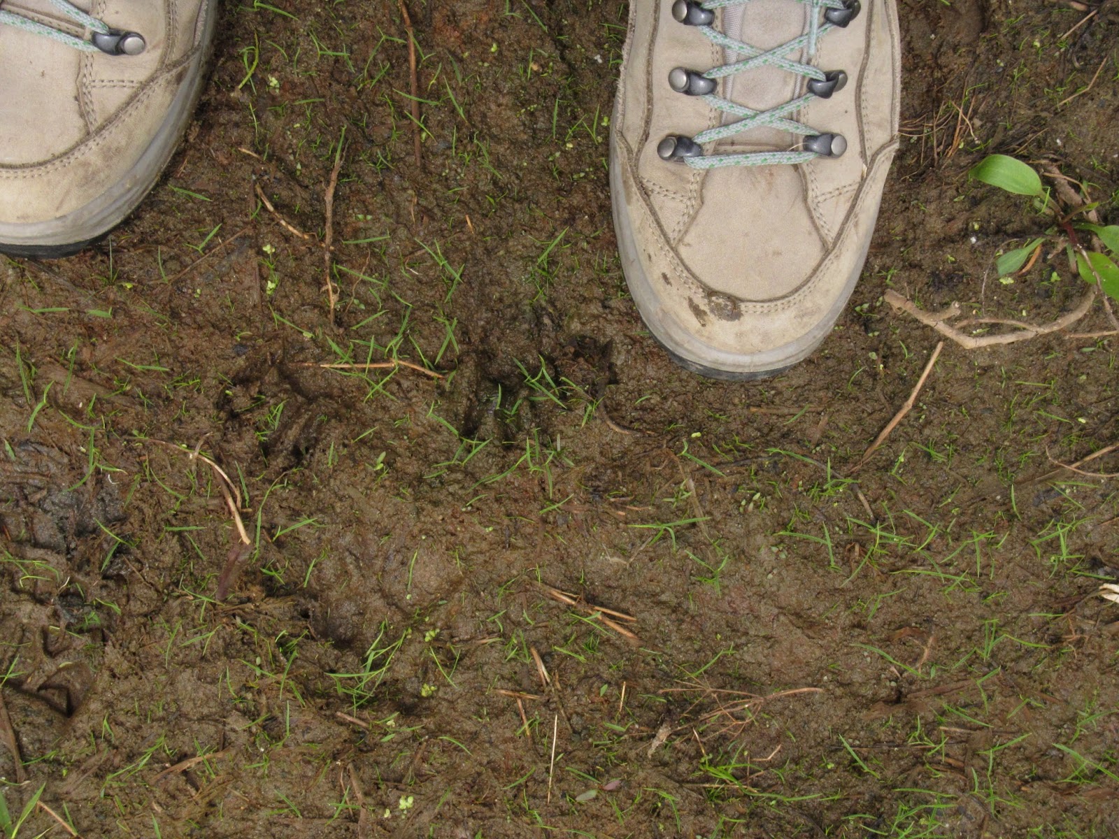
I don't regret starting my exploration in the "wrong" spot, the wet fields had things to discover, too.  I'm not the only one who has visited them, the deer obviously like to come there to get a drink.


Frogs were everywhere, hopping back and forth as I crossed through the grasses along the edge of the water.  Even after seeing them jump sometimes it was hard to pinpoint them, their camoflage works very well.


Another set of tracks looked too small to belong to a raccoon, maybe a porcupine?


Eventually I made my way over to the woods, where I broke through into the undergrowth to find a colony of what was probably Hispid Buttercup.

This is the mother my kids have to live with, how do they do it?  

I was at my most inventive, using the rubber boots I toted along as a spot to perch my Gorillapod!  Luckily I didn't need the boots, but I wanted them along in case I had to cross any watery spots.  From the buttercups I marched back towards the road and found the other parking area...and masses of Woodland Phlox.


I continued on through the blooms, keeping my eyes peeled for more delights.  The fragrance that wafted up as I walked through was nice but nothing else was in bloom yet and as I got closer to the river the only thing I discovered was that it's not too early for mosquitoes after all.  I kept up a good pace so I wouldn't get bitten, and the farther I got from the river the less there were.  And even though I was careful to tuck my pants in to my socks and check often for ticks I didn't encounter any of those pesky guys.  I've noticed I'm less likely to pick them up in really wet areas like this one.

No ticks on me!

At the parking lot for the Sugar River Park two gents were out fishing with the kids, one so young she was in the stroller.


When I asked how deep the river was the men didn't answer me (perhaps they thought I might stay and talk their ears off), but the youngster was eager to tell me he'd been busy catching snakes and frogs (worms on fishing poles tempt frogs as well as fish according to him).  He demonstrated his technique for me and showed off his prizes in their bucket.

This is the child my mother had to deal with.
 I climbed trees and caught frogs and snakes too.
I also put dresses on puppies and hid from Indians and bad guys in the woods.

Today I'm at home and all is quiet.  Cory is in bed with a cold, Katrina is gone for the weekend and Wayne is working a double shift again.  My parents stopped over and I made them some homemade vegetarian split pea soup with some paninis for lunch and Katrina is bringing home cupcakes tonight to have while we watch "Game of Thrones" and "Orphan Black".  Maybe I should go for a walk before the cupcake eating begins....

Me and my babies, May 2002 

Look at my kids 13 years ago, they really do grow up too quickly! Happy Mother's Day, Ladies!